Formula 1 rolls into Silverstone this weekend for the
British Grand Prix. The latest weather forecast indicates a possibly changeable
weekend, but there’s plenty of uncertainty over the exact details at this lead
time. Full details can be found below; this article will be updated throughout the week.
For the latest forecast information, follow MeteoMotorsport on Twitter/X, Threads, Instagram, and Bluesky. Visit the F1 Weather Centre for the latest automated daily forecast and satellite and radar maps.
First published: Monday 30 June. Last updated: Evening of Saturday 5 July.
Sunday 6 July
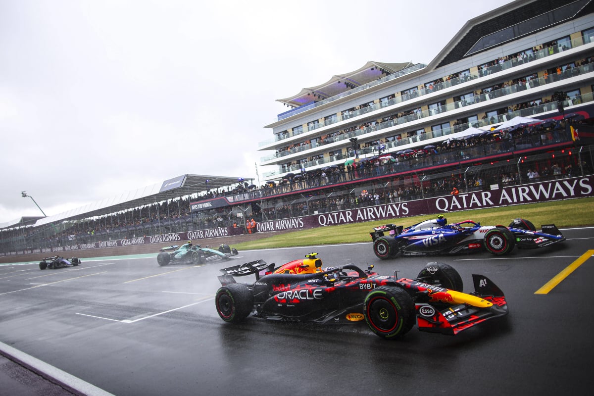
Mostly cloudy with potentially some sunny intervals during the afternoon, with a high of around 19–22°C. Conditions are expected to remain unsettled with a moderate to high risk (60–90%) of some rainfall at some point in the day, though the hourly risk of rain changes throughout the day, as discussed below.
Having previously trended downwards, rainfall totals have increased in the last 48 hours. The total accumulated rainfall on Sunday is expected to range between 1.5–9 mm.
A majority of the expected rainfall (0.8–7.6 mm) is forecast to fall between 07:00 and 13:00 local time, with high-resolution forecast models indicating a period of hit-or-miss moderate intensity showers between 09:00 and 14:00 local time, So Sunday morning's F4, F3, and F2 races are likely to have the highest hourly risks of rain.
About two-thirds of the global models produce some rain during the afternoon, with the hourly risk of rainfall is likely to fall to low (20–40%) by the start of the Grand Prix at 15:00 local time, and decreasing throughout the afternoon. Rainfall totals between 13:00 and 19:00 local time range between 0–3.1 mm. Therefore, there may be a situation where the morning's rainfall is drying up over the course of the day, and a low risk of an additional light passing shower.
Slightly lighter winds than Friday and Saturday, but it is still expected to be a moderate 15–25 km/hr breeze from the northwest, with local gusts up to 50 km/hr possible. This slight change of wind direction from being from the southwest to being from the northwest could be critical, and will likely result in a crosswind through Abbey, the Maggots, Becketts, and Chapel complex, and Stowe, with a tailwind into Copse, and headwind down the Wellington straight. Model forecasts indicate the gusts will pick up from 14:00 local time (after any of those morning showers have passed)
MeteoFrance forecast for Sunday:

Previous forecasts
Outlook
Fresher than the recent heatwave conditions experienced across much of central and southern England. Should be pleasant through Thursday and Friday. Turning more unsettled across the country into the weekend, although not everywhere will see rain or showers, and those that do will have brighter weather between the showers.
Thursday 3 July
Partly cloudy throughout the day with highs of around 22–24°C. A gentle breeze from the northwest or west. The risk of rain is very low (<5%). There’s no on-track action on Thursday, but for fans attending Sky Sports’ F1 Show on the main pit straight at 18:00–19:00 or the launch party at the main stage from 19:00, expect partly cloudy skies with temperatures of 20–23°C with a gentle breeze.
Friday 4 July
Similar conditions to Thursday with mostly sunny conditions in the morning, turning partly cloudy through the afternoon, and lots of high-level cloud by the early evening. Highs of around 23–26°C. Slightly windier than Thursday with a moderate 25–30 km/hr breeze predominantly from the west-southwest and gusts of possibly up to 55 km/hr by the afternoon. This wind direction will mean a tailwind through Abbey and a crosswind through the Maggots, Becketts, and Chapel complex . The risk of rain throughout the day is very low (<5%). Turning cloudier overnight into Saturday morning
Saturday 5 July
Some light rain passed over between 00:00 and 03:00 this morning and has now cleared to the east-southeast.
Most forecast models currently indicate a mostly cloudy to overcast day with only an occasional sunny spell. Afternoon highs are expected to be around 18–23°C, likely dictated by the level of cloud cover.
There is a moderate risk (30–60%) of scattered showers at some point on Saturday, some of which could be thundery. Rainfall totals are likely to range between 0–2 mm for the day, which is lower than forecasts earlier this week. An accumulation of between 0–0.8 mm is possible between 07:00 and 13:00 local time, with 0–0.4 mm possible from 13:00 local time onwards; these forecasts are lower than previously forecast a few days ago. The hourly risk of rain reduces to around 10–30% from midday onwards.
It is worth noting that low hourly risk can still add up. For example, on a day with scattered showers and a 20% rain chance per hour, over a 4-hour period, the chance of remaining dry is 41% (0.8 × 0.8 × 0.8 × 0.8), while the chance it rains at least once across the 4 hours is 59%.
Any showers are expected to be light and will be hit-or-miss, so there's also a possibility that the showers do not directly cross the circuit but pass nearby. The exact timing and intensity of any rainfall remains uncertain — follow our social updates for the very latest radar situation.
As windy as Friday with a moderate to fresh 25–30 km/hr breeze from the southwest with local gusts of up to 55 km/hr by the middle of the afternoon. Like on Friday, this wind direction will mean a tailwind through Abbey and a crosswind through the Maggots, Becketts, and Chapel complex.


